Jack Elton-Walters on the confusion sparked by the Covid-19 tiers.
It may not be its most controversial aspect, but the government’s coronavirus tier system has served to highlight existing confusions, grievances and out-dated ideas about which county certain boroughs, towns and cities now fall into.
Previous to the most recent, month-long lockdown in England, those in the London Boroughs of Bexley and Bromley who have never quite grasped their transfer to Greater London in the 1960s – including plenty of people born years after the change – could fall back on feigned ignorance about ‘Kent postcodes’ to continue operating under Tier 1 restrictions – as per places actually in Kent, while Greater London was under Tier 2.
Now, with the situation significantly reversed as Kent moves into Tier 3 and with it the harshest restrictions, there’s likely to be a collective awakening across south east London to just which county it is that people find themselves in.
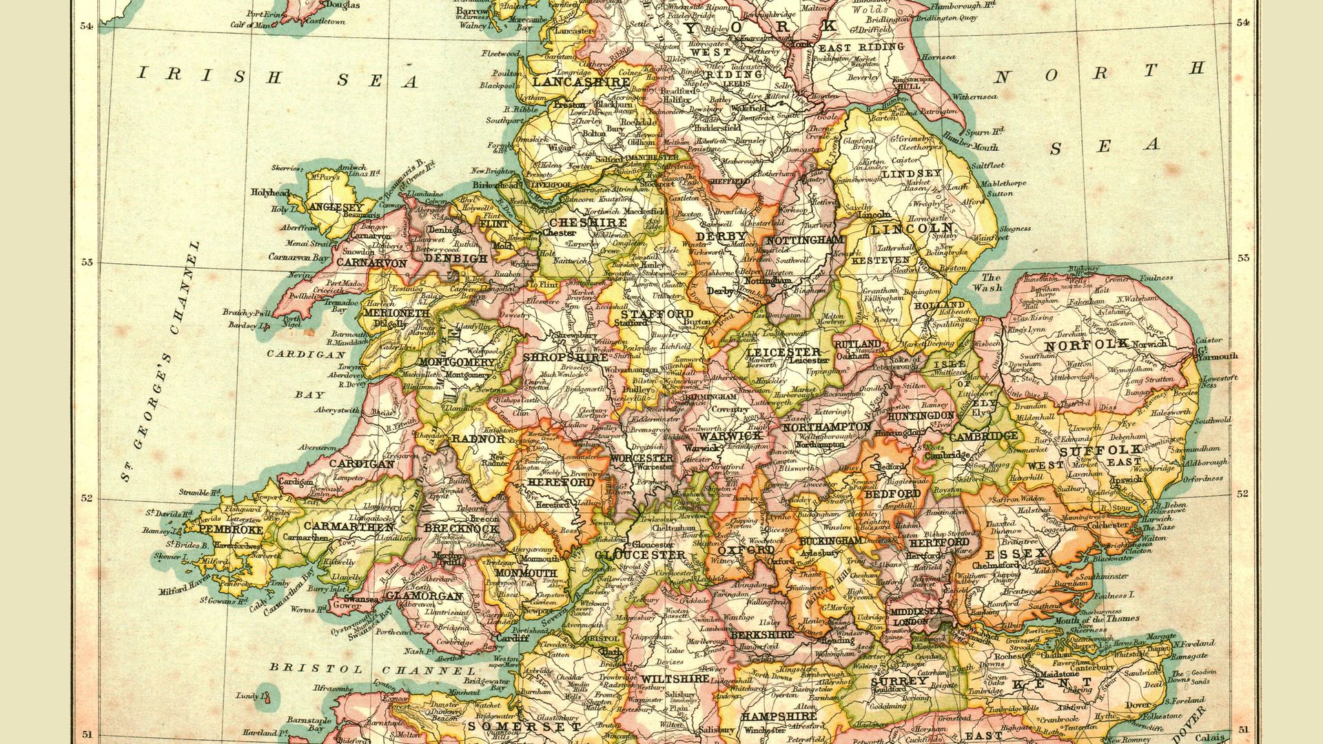
The London Government Act of 1963, which was implemented two years later, redrew the map of the capital and its bordering counties, incorporating large swathes of Kent, Surrey and Essex, plus a bit of Hertfordshire, and ended the existence of Middlesex as a tangible place – outside of the name of a hospital and a cricket team – altogether.
Now, 55 years on from Sutton and Croydon resolutely not being in Surrey anymore, there are chunks of that county – within the M25 and bordering Greater London – that look like they really should have been included in the capital. This is most obviously highlighted by the way the Royal (London) Borough of Kingston upon Thames juts into Surrey and is therefore bordered on three sides by regions of its former county.
Objections by the residents of Epsom and Esher kept these areas outside of Greater London, although it’s near impossible to see where London becomes Surrey, and vice versa, as the suburban areas sprawl out without break.
The biggest identity crisis of south west London also centres around Kingston, which still hosts the seat of Surrey County Council: surely the only authority in the country that doesn’t have responsibility for its own doorstep. This is set to be remedied with the council moving its headquarters to Woking, outside the M25 and the shadow of London, in the coming years.
People born decades after all these changes to counties up and down the country still appear confused as to which county they live in. One of those is Labour MP Wes Streeting. The 37-year-old’s constituency of Ilford North is in the London Borough of Redbridge, yet according to his social media bios his location is ‘Barkingside, Ilford, Essex’.
Boundary changes aren’t unique to the south, either. Just ask the residents of Barnoldswick, previously in the West Riding of Yorkshire, but following boundary changes in 1974 they awoke to find they’d be shifted into the neighbouring – and historically rival – county of Lancashire.
Lancashire is a county that’s had as much land taken from it as it’s received from bordering areas, in particular as a result of the formation of Greater Manchester in the same 1974 boundary changes. Just where Lancashire begins when you head north out of Manchester is open to debate for many, 50-year-old council designations being ignored in favour of historic county borders.
The contiguous nature of suburbia’s sprawl away from city centres can be credited with much of the reason for urban areas of outer counties being lumped in with city regions – Sutton is much better linked with Balham than it is with Hindhead – and none have a stretch of sea behind which to stand while voicing their ‘well actually, Beckenham’s in Kent’-style arguments.
That’s the case for the Isle of Wight. Thanks to the Solent – which is likely to be responsible for the island finding itself in Tier 1 along with only Cornwall and the Isles of Scilly – its separation both literally and politically from Hampshire, the county that borders it across the water to the north, is clear.
Even so, many people still get mixed up about whether the Isle of Wight is in Hampshire. It is not. The opening of a revamped Tesco Extra on the edge of Ryde a few years back caused consternation when the supermarket’s address was given as ‘Ryde, Hampshire,’ and more recently news outlets have felt the need to state that ‘Hampshire (except the Isle of Wight)’ is in Tier 2. An unnecessary stipulation akin to saying, although on a smaller scale, ‘England (except Cardiff)’.
Paying council tax to a London borough and voting for the mayor of London may never convince some people that they live in the capital, but if Brexit has taught us anything it’s that emotion and belief in intangible things (think ‘sovereignty’) can always supersede fact, so don’t expect universal acceptance of historic county regions’ shift to ‘greater’ city denominations being universally accepted soon.
Just wait until a Greater Birmingham is formed or instead the West Midlands given a similar status to Greater London.
Anyway, I’m off to Bury. Where’s that again?
Jack Elton-Walters is originally from the Isle of Wight, which is not part of Hampshire
 Most popular


Farage is forced to explain his finances


Biden’s long-awaited decision is game-changing


Sanity is coming home

Trump is losing it